


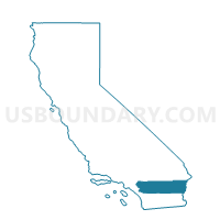
Voting District 55205, Riverside County, California
About
Outline

Summary
| Unique Area Identifier | 537294 |
| Name | Voting District 55205 |
| County | Riverside County |
| State | California |
| Area (square miles) | 0.41 |
| Land Area (square miles) | 0.41 |
| Water Area (square miles) | 0.00 |
| % of Land Area | 100.00 |
| % of Water Area | 0.00 |
| Latitude of the Internal Point | 33.99698970 |
| Longtitude of the Internal Point | -116.99467050 |
Maps


Graphs
Select a template below for downloading or customizing gragh for Voting District 55205, Riverside County, California


Neighbors
Neighoring Voting District (by Name) Neighboring Voting District on the Map
- Voting District 33700, San Bernardino County, CA
- Voting District 55145, Riverside County, CA
- Voting District 55190, Riverside County, CA
- Voting District 55315, Riverside County, CA
- Voting District 55480, Riverside County, CA
Top 10 Neighboring County Subdivision (by Population) Neighboring County Subdivision on the Map
- San Gorgonio Pass CCD, Riverside County, CA (86,603)
- Yucaipa CCD, San Bernardino County, CA (51,787)
Top 10 Neighboring Place (by Population) Neighboring Place on the Map
Top 10 Neighboring Unified School District (by Population) Neighboring Unified School District on the Map
Top 10 Neighboring State Legislative District Lower Chamber (by Population) Neighboring State Legislative District Lower Chamber on the Map
Top 10 Neighboring State Legislative District Upper Chamber (by Population) Neighboring State Legislative District Upper Chamber on the Map
Top 10 Neighboring 111th Congressional District (by Population) Neighboring 111th Congressional District on the Map
Top 10 Neighboring Census Tract (by Population) Neighboring Census Tract on the Map
- Census Tract 87.03, San Bernardino County, CA (7,745)
- Census Tract 438.11, Riverside County, CA (3,877)